Roopkund Trek - Journey to the Mystic Lake
The renowned French novelist, Marcel Proust once said, “The real voyage of discovery consists not in seeking new landscapes, but in having new eyes.”
There are few experiences that open up not just your eyes and heart, but also your lungs and mind. The trek to the mysterious skeletal lake ‘Roopkund’ definitely did that to me.
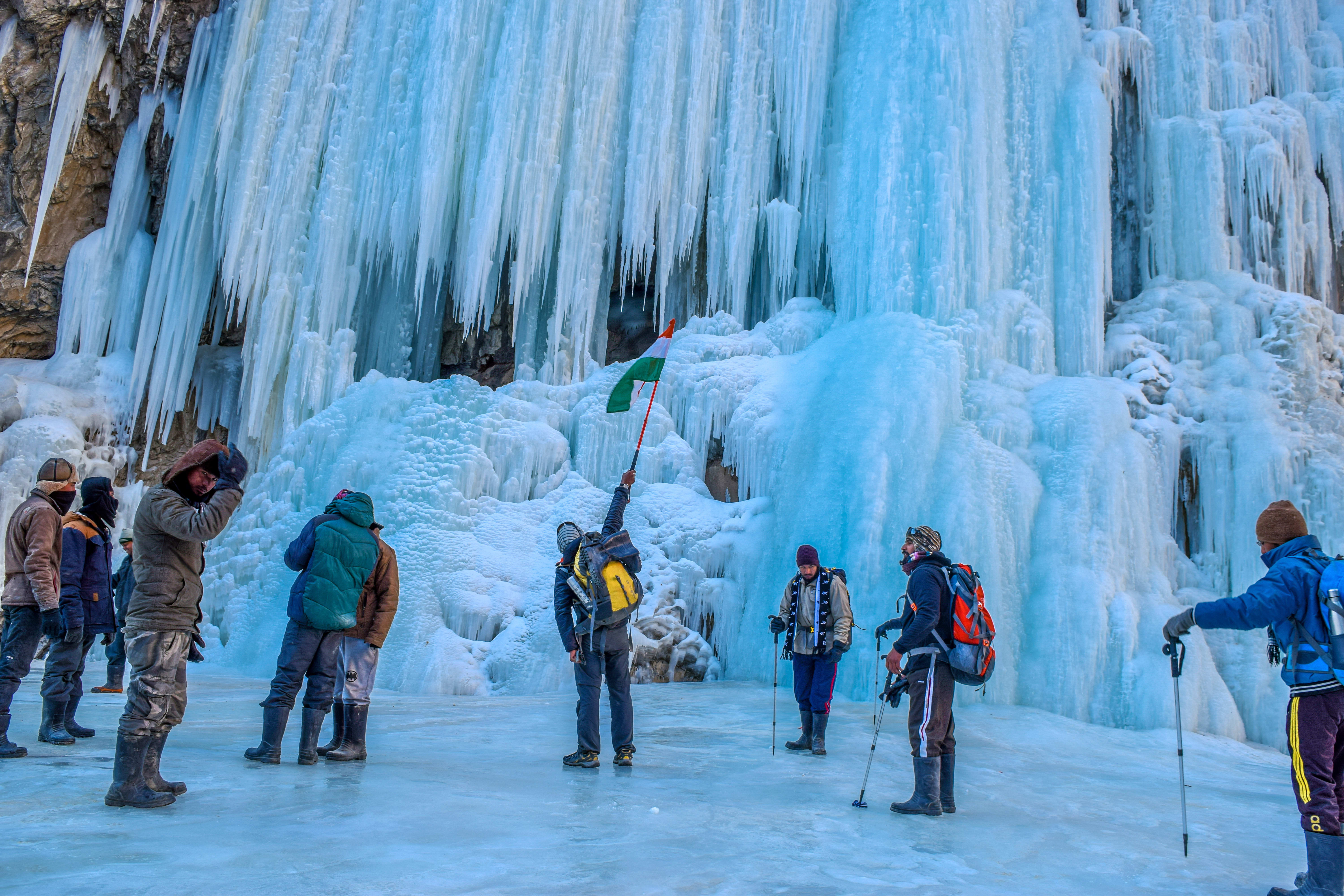
Located in heart of Chamoli district of Uttarakhand State, India, Roopkund Trek is a 8 day journey into the Garhwal Himalayas, starting from silhouette villages, to misty forests, passing through gorgeous lush green meadows (Ali and Bedni), onto the rocky terrain in Pathar Nachuni to valley of Brahma kamals, and finally, to the mystery laden Roopkund lake, which till date remains an enigma.
In order to solve the puzzle surrounding the hundreds of skeletons scattered around the lake, various expeditions have been made by scientists from all over the world. It has even been documented by the National Geographic team, which has only contributed in making the trek legendary, in the truest sense of the word..
Roopkund Trek is one of the most popular and recommended high altitude trekking destinations in the Himalayas. And for me, it was a beginning of an addiction of spending days in unspoilt nature.
6 of us registered for the trek through ‘Trek the Himalayas’, with a burning desire of venturing deep into the realm of Himalayan fantasies, and returning with lifelong memories…
So, let the magic unfold….one more time….
Day 1 : KATHGODAM – LOHAJUNG
Drive : 210 kms
Altitude : 7662 ft
To reach Loha Jung, our base camp and a tiny little hamlet in Chamoli district, I took an overnight train journey from New Delhi to Kathgodam.
 |
| sleepy destination |
From Kathgodam, it was close to a 10 hour bus journey, cruising along the Kosi River, glimpsing through the snow capped mountains which were coming closer and closer. Slowly the calm waters of Kosi River gave way to the blustery Pindar River.
The journey turned out to be enriching in many ways. The sights were mesmerizing indeed. We started in the Kumaon area of Uttarakhand, and slowly ventured into Garhwal.
Bus Route
Kathgodam–>Bheem Tal–>Almora–>Kausani–>Gwaldam–>Dewal–>Lohajung
Apart from capturing the natural beauty that the beautiful state of Uttarakhand has to offer, the journey also helped the entire batch of 15-20 trekkers to gel with each other. After all, this small batch of strangers was going to be like a family for the next week, in the midst of nowhere.
Loha Jung is a tiny little village, tucked away in the laps of the Himalayas. Had it not been for the Roopkund trek, it would have still have remained hidden away from the outer world.
At the base camp, we were formally introduced to our group which generally consists of 15-120 members excluding Trek Leader and local guides and of course lifeline for the campers i.e. support staff (consisting of cooks, helping hands, luggage carriers). My group included people from all over the country like Chennai, Hyderabad, Mumbai, Ranchi, Uttarakhand, Delhi, Nagpur, Varanasi.
After an update on how the trek would look like, we chatted over hot pakoras and tea. It felt great to be surrounded by these like minded people, many of whom had already successfully completed many well known treks.
 |
| kulling from the field |
Our home stay was really a simple yet cozy affair. The rooms were clean, and the beddings looked as inviting as ever. The bus journey was long and tiring. So there I was, on my bed, with droopy eyes, but a spirited self, all ready to welcome the next morning, and start my ascent into the grand Himalayan world…..
Day 2 : LOHAJUNG TO DIDNA
Trek : 6.5 km
Altitude : 7662 ft to 8045 ft
We were scheduled to commence the trek at 6.30 am. Standing on the terrace of my homestay, I was able to have a glimpse of the towering Nanda Ghunti peak on my right, and the tiny Didna village, tucked away in the lap of the mighty Himalayas. From where I was, it didn’t seem a big deal for a full days trek. Even it’s altitude seemed similar to that of Lohajung.
But here was the catch. In the mountains, they don’t have any flyovers to connect two points on different hills!!! We first had to descend to the bottom of the valley, cross the river, and then start ascending to the top of the next hill to reach Didna….
The group was super charged up for the mystery that would unfold in next 7 days. Although all of us had read something about the journey, the anxiety was clearly evident on everybody’s face. After a wholesome breakfast, we finally started our trek from Loha Jung to Didna Village.
The trek began with a steep descend through oak forests, waterfalls, primeval river and long stands of bamboo. It’s a beautiful stretch indeed. You’ll come across some small waterfalls on the way, but you should be wary of the slippery rocks that remain scattered during the first half an hour of the descend.
After a relatively easy n stunningly beautiful 1.5 hrs trek through the deep forest, we reached an open field, that happened to be our first and the only pit stop for the day. We could spot Kulling, a tiny village up the hill, from here. We were told we would pass through Kulling on the last day, while on our way back from Wan to Lohajung.
 |
| lost in the greenery |
A few deep breaths.. A few gulps of much needed water.. A few photographs clicked..Now the group was ready to make a move forward. From this point, it was close to a half an hour trek through some flower laden fields and a cross over the Wan river, till we completed the 4.5 kms trek to the Raun Bagad bridge, and came across one of the tallest waterfalls I have ever seen in my life..
Through the bridge, we came across the other side of the Neel Ganga River. It is from this spot that the the toughest part of the day was about to start. It was a fairly steep climb of around 2 kms to reach Didna Village from here. Huffing, puffing and stretching our lungs to its limits, we finally completed the 2 hour toil, and reached Didna, located at an altitude of around 8000 feet.
 |
| the didna lunch |
Didna is a typical secluded Himalayan hamlet, surrounded by beautiful waterfalls, green pastures and wild flowers. Our stay for the day was in a local’s house, the look and feel of which was in a perfect sync with its surroundings; rugged and charming. It was a typical village villa, with small windows, and made with the use of mud and wood.
Since we reached here by lunchtime, we had the entire day at our disposal. It was all about relaxation now. A game of carrom for few, while a short nap for some others. Few like me opted for a short walk to explore the beautiful and serene surroundings.
 |
| home in the hills |
How I wished the night may never end…….
Day 3 : DIDNA to ALI BUGYAL
TREK : 10.5 km
ALTITUDE : 8045 ft to 11320 ft
Bidding adieu to our gracious hosts, we set out for probably the most scenic route of the entire trek. We started the trail covering the village, and then on to a moderate ascend for about an hour, reaching a spot called Tolpani. At a height of around 1000ft above Didna, it is an open field with a cluster of huts belonging to the shepherds. We used the ground as our first pit stop for the day and refill our water bottles from the stream that passes through it.
 |
| through the forest |
The trail from this point was a beautiful but steep ascend through a Birch, Oak and Rhododendron forest. A trek of close to an hour, and we were right in the middle of a beautiful lush green meadow surrounded by a thick pine forest.
 |
| the meadow |
 |
| haunting |
 |
| just there |
Reaching atop, we were given some “me time” at the meadows. Just sitting there and looking at the never ending green lustrous fields itself relived me of all the pain of walking continuously for 4-5 hours. It was simply “magical”. I opened my packed lunch of masala aloo, paratha and boiled egg (at that time I felt that I had never eaten more delicious food ever in my life) and slowly finished it, gasping in the beautiful surroundings of Asia’s highest meadow.
 |
| Ali Bugyal |
 |
| the campsite |
At our campsite, one could see horses roaming around in the pastures, which is a rare scene for the “civilized us”.
 |
the serene surroundings |
DAY 4 : ALI BUGYAL TO PATHAR NACHAUNI VIA BEDNI BUGYAL AND GHORA LAUTANI
TREK : 7 KMS
ALTITUDE : 11320 FT TO 12,818 FT
“Today’s the easiest day of Roopkund trek”, announced Hardik, our trek leader, to the amaze of the entire group. We had to hike a decent altitude from around 11,300ft to 12,800ft to our next stop, Pathar Nachauni, through Bedni Bugyal and Ghora Lotani. Though covering a distance of 7 kms at this altitude may seem a herculean task for many, the gradual ascend and the picturesque surroundings make the day’s trek a beautiful experience indeed. But one does start feeling the thinning air and change in weather, which, at one minute is sunny and at the next, becomes dark and cloudy.
 |
| the day commences |
After about a 2 km of gradual ascend from our campsite, we were overlooking the picturesque Bedni Bugyal. This lush green meadow is decorated with varied fauna and a small lake named Vaitarani (Bedini Kund).The towering Trisul and Nada Ghunti is visible from here on a clear day. Legend has it that the four Vedas were written in the meadows of Bedni Bugyal.
 |
| bedni bugyal |
The group’s delight knew no bounds when Hardik informed that the trek from this point till Pathar Nachauni would be a moderate walk with just a little ascend. Stepping further, the cheer from our trek staff, their narration of the local fables and stories, and of course, the wonderful vistas gave us the much needed motivation to push ourselves.
 |
| the captivating views |
 |
| the sudden change in landscape |
True to its folklore, further from this point, the landscape turned rocky with little pastures. From Ghora Lotani, the track changed its position from the left side of the cliff to its right. And what a stroll it was..1 km of sheer magic, to say the least..You will picture breathtaking views of nature’s artistry down the road at its full glory. It turned a bit cloudy, which only added to the mystery in the air..I could hear the silence speak !!!!!!
After about 8 kms of gentle walk, we reached our campsite for day the night, Pathar Nachauni.. And surprise surprise!!! There were two dhabas situated there which served the best coffee I had in my entire life. Everybody was in dire need of a good night’s sleep after the daylong toil. Waking up early next morning was very crucial, as a treacherous day was waiting for all of us ahead.
DAY 5 – PATHAR NACHAUNI TO BHAGWABASA VIA KALU VINAYAK
TREK – 4 KMS
ALTITUDE – 12,818 FT TO 14,117 FT
Sitting on a rock near my tent, I was watching one of the most beautiful sunrises..the rays kissing the dew laden grass..giving the much needed warmth, not only to the aching body, but to the spirited souls as well. Spirited souls..yes, that’s the right word to describe the entire bunch of fellow trek enthusiasts. It was so inspiring to see the zeal on everybody’s faces, even after four days of sweating it out in these unknown parts of the mountains, in this wilderness at close to 13,000 ft.
So then..a hot breakfast, and we were ready to hit the track again, on to the our destination for the day.. Bhagwabasa, located around 14000ft above the sea level.
 |
| en route pathar nachauni |
Just about 1 km of a gradual ascend from the campsite, and we were face to face with the actual Pathar Nachauni spot. The term Pathar Nachauni translates to “Dancing Stones”. Legend has it that very long ago, a king was making his annual pilgrimage to please Goddess Nanda Devi. He set up his camp here, and asked the royal dancers to perform. This infuriated Goddess Nanda since women were not allowed beyond Ghora Lotani and she sent the three dancers to “patal lok” or simply to hell. There are three big deep dugs which can be connected to the folklore!!!
The trek to Kalu Vinayak is steep, narrow and challenging. The combination of a high altitude and the steep ascend made this stretch a rather difficult one. It felt as if the heart was popping up in the mouth, that forced me to halt at every few steps to take a deep breath and try to fill the lungs with depleting oxygen !!!
 |
| divinity at 14000 ft |
The sight of the small stone temple, along with the sounds of the bell piercing through the silent surroundings, was indeed one of the most satisfying experiences of the entire trek. Sitting besides the temple at an altitude of 14200 ft, a sense of pride and achievement prevailed amongst us, and the first sight of black idol of Lord Ganesha made our belief in ourselves even stronger.
This place also has an interesting folklore. This is where Lord Ganesha is alleged to have been standing guard, while Parvati was taking bath in the Roopkund Lake. It is from here that one can see the Roopkund crater for the first time.
After offering our prayer and posing at the spot, we started our descend of around 1.5 kms to Bhagwabasa. The descent was a big respite after the steep ascend to Kalu Vinayak.
 |
| trail to bhagwabasa |
The trek to Bhagwabasa is quite uneven and zig-zag. It is essential that proper safety gear and at least three layers of clothing are ensured, as one will be reaching quite a high altitude of more than 14,000 ft. The flora also diminishes along the way giving more way to rocky terrain, the sight of which is so overwhelming that one realizes what a minuscule part we are of this planet!!!
Just a bit further on the trek, and we were surrounded in a field of the divine “Brahma Kamal”, which is also the state flower of Uttarakhand. The flower blooms only during the monsoon months. What a rare sight it was !! “They blossom only in the higher altitudes of the Himalayas, above 12000 ft”, said one of the porters..
 |
| among the brahmkamals |
Finally, making our way through the rocky terrain and a cloudy weather, we reached our campsite at Bhagwabasa.The term Bhagwabasa translates to “abode of the tiger”. The legends say this is where Goddess Parvati left her tiger and went to take bath in the Roopkund lake.
At the campsite we were treated with “Chilli Soya” and hot soup which was more than anyone expected at this hostile terrain. The trek leader strictly insisted the group on taking acclimatization walks and not hitting the comforts of the warm sleeping bags inside the tents.
 |
| lunch in the heavens |
The weather was cloudy and gloomy, and had it not been for the constant talks and cracking of jokes amongst the group, it would have been a complete pin drop silence in those surroundings. It was an extremely chilly evening, and all that the group wanted was a clear day tomorrow, perfect for doing the summit climb.
To say that each one of us in the group was excited would be an understatement. In the shadow of the towering Trishul and Nanda Ghunti peaks, I kept twisting and turning in my sleeping bag throughout the night… waiting for the whistle.
DAY 6 – BHAGWABASA TO ROOPKUND AND BACK TO PATHAR NACHAUNI
TREK – 10 KMS
ALTITUDE – 14,117 FT TO 15,756 FT ( 16,200 FT IF GOING FURTHER TO JUNARGALI )
And there I heard..at 3:30 am before the dawn broke..a sharp whistle by our trek leader. A step outside my tent, and I realized this was the most hostile surrounding I had ever been in my entire life.. Pitch dark, freezing temperature, rocks to walk on, and what not !! We stood out in a line and were briefed about the safety tips. “Breakfast at Roopkund and lunch at Bhagwabasa”, said Hardik, the trek leader..Counting check, backpack check, head torch check, baklava check, trekking sticks check…all abode..LETS SUMMIT !!.
It was so dark and rocky in the beginning that the entire batch walked right behind each other..The path is just not possible without a torch. A head torch is definitely more convenient as your hand will remain free (you’ll hold the trekking stick in the other hand).
It was for the first time that I was expiercing a ‘trek in the dark’. And man, was it scintillating. The stars in their full glory, and those outlines of the towering peaks all around !! It was so silent that the only sound visible were those of the clapping of shoes and my own heartbeat..
Once you cross the rocky terrain, the path is not that complicated to climb. But even the 4km challenges you and takes your breath out and tires you to the limit. From Bhagwabhasa, your first checkpoint is Chirianag, which is a group of few loose slate stones. The step climb is perplexing to say the least. It was here that we came across a lady from another group, sitting on one of the stones. She was suffering for acute Mountain Sickness and was about to be taken down to the lower altitudes. Sad indeed…
In a few minutes, we witnessed the grand spectacle of the first rays of dawn hitting the peaks of the imposing Trishul, Nanda Ghunti and Mount Chaukhamba..
 |
| besides the lake |
And finally we were there.. Around 2-3 hrs of steep climbing in the thinning air, we reached Roopkund, at an altitude of 15,696 ft. Such was the sense of achievement in the entire group., that there was hugging and handshakes going all around the place. An achievement, it surely was. A high altitude trek of close to 16000 ft is by no means a small task, and not everybody who starts, reaches this point !!!!
The first sight of the not so large lake might not appeal to everyone. “Such a arduous trek of 6 days, for such a small lake”, said one of my friends. But the legend of the Roopkund lake is popular not only due to its size, but because of the mystery and enigma it holds..
 |
| unsolving the mystery |
Till date, the mystery behind the skeletons scattered around the lake has not been solved. Many theories have been attributed to their presence. According to one of them, in the 8th century AD, once a king and his fellowmen were going on a pilgrimage to Nanda Devi, and unfortunately, a severe hailstorm led to their deaths. The skeletons were sent to a forensic lab, and the dates did match !! Even a crew from the Discovery Channel visited the lake to study the skeletons and have made a documentary on the mystery attached with it…
According to folklores, while Goddess Parvati and Lord Shiva were on their way to Kailas, Goddess Parvati was feeling very dirty after killing the demons and wanted to clean up. Lord Shiva created the Lake with his Trisul and Parvati dipped herself in the blue waters and could see her clear and beautiful reflection in it which was why the lake was named Roopkund.
The trek leader informed that we have an hour to spend here, as at such a height, the weather can change drastically at anytime. We had two choices. Either to roam around the lake or trek further up to the Junargali pass, at an altitude of 16,200 ft. You can go to Junargali only if the weather permits, and that day, the Gods were with us….
The views of Mount Trishul from Junargali is simply jaw dropping. I literally felt being on top of the world. Spending sometime with nothing but the air between me and Trishul, and clicking some breathtaking pictures for the memories, we started our decent to Bhaguabhasa and from there to Pathar Nachuni.
 |
| the descend starts |
It may sound surprising, but the descent along the path is more difficult than the ascent, since it is so steep that one might have the feeling of falling down from the top.
The bodies were descending for sure, but the thoughts were still with the lake, the skeletons and the mysteries.. There was non-stop chattering throughout with the fellow trekkers about each other’s experience. This trek down, covering over a distance of 10 kms, is quite tough, considering the fact that we started so early and already toiled to reach Roopkund.
 |
| the long walk back |
We reached Pathar Nachauni around 4 all exhausted. However, the pain did surely end with a gain.. A cake made without an oven at 12000 ft. to celebrate our summit lay there to be feasted upon…Definitely our eventful day ended on a sweet note!!!!
DAY 7 : PATHAR NACHAUNI TO LOHAJUNG VIA BEDNI BUGYAL AND WAN
TREK : 18 KMS
ALTITUDE : 12,818 FT TO 7,662 FT
And so..there we were..Getting into our trekking shoes for one last time. The final day of the trek lay ahead of us, and the feeling was a mixed bag of excitement and emotions I would say.
It was going to be a long day of close to 10 hrs to return back from where we started on the first day. It was a gradual descend of almost 18 kms through a range of terrains. The trek started through the same route that we took whilemoving towards Roopkund; the only difference was that tis time the direction was opposite. Passing through Ghora Lautani, we made our way into the lush green meadows of Bedni Bugyal.
 |
| Bedni up close |
It was all downwards from here. And how abrupt was the change in the scenery..The grassland soon made way to a line of trees, and slowly the group ventured into a dense forest area called Gharoli Patal. The soft whistle of the leaves, bird tweeting and the cool wind past the ears were the un-forgetful pleasures, that we would hardly experience in the chaotic lives we were about to get back into.
The descend was steep and quite tricky. At many points, we were literaly walking on rocks. It was really challenging to keep the balance. Just a step here or there, and the result could have been quite painful!! ” Ascending is much more easier than the descent”, somebody murmured from behind. How right he was….
We continued our journey till reaching the banks of the river of Neel Ganga, the noise of which we started hearing some time back itself. It was time for the much needed lunch break. We dipped our aching foot in the cool water, which at least for me, was nothing less than a luxury Spa session in the woods.
 |
| the last few steps |
Although not wanting to leave the place, we slowly paced towards Wan village – back to civilization. Through the narrow paths of the village we encountered smiling faces of children respectfully nodding their heads to say “Namaste”, which brought a smile to everyone’s face. Wan feels like very much at home, a big village with hills, mountains and smiling faces. As we walked a bit further, we finally came across the vehicles waiting to pick us up. All aboard the vehicle, we zipped over to Lohajung base camp, via the tiny Kuling village, where all we were asking for was a bucket of warm water to soothen up the tiring muscles..
At the dinner table, we all sat together rejoicing our expectations of the trek and the experience that we were taking back with us, which will be cherished forever. Its one thing to visit a popular hill station or tourist destination and completely different in experiencing nature so close that every day surprises you.
Roopkund was not just a trek, it was a way of experiencing one’s inner self. One of the most special 7 days of my life. The ardous walks, the puffing lungs, the cramped legs, the aching backs, the most scenic vistas, the sense of accomplishment, the friends made…
Can life be ever lived any better???
Also check out: Popular Places for Trekking in Uttarakhand


Wow, the Roopkund trek sounds absolutely fascinating! The scenery in those photos is breathtaking. For those seeking adventure a little closer to sea level, WanderOn has some incredible Singapore tour packages that you might enjoy! WanderOn Singapore Tours: https://wanderon.in/international-trips/singapore-tour-packages.
ReplyDeleteSingapore might not have the mountain peaks of the Himalayas, but it offers a different kind of adventure. You can explore vibrant cultural districts, try thrilling rides at Universal Studios, or even go kayaking through the stunning mangroves.
What an enthralling journey you've taken us on through your words! The Roopkund Trek sounds like an adventure straight out of a fantasy novel, with its mystical lake and the secrets it holds. Your vivid descriptions truly transported me to the rugged beauty of the Himalayas, with every step seemingly uncovering a new wonder. You can refer this https://wanderon.in/blogs/roopkund-trek-uttarakhand other blog for more detailed information.
ReplyDeleteGreat article. The rropkund trek uttarakhand sounds like an incredible adventure.
ReplyDeleteInsightful. Roopkund trek in Uttarakhand is one of the great experiences one can have in Uttarakhand and have a memorable experience.
ReplyDeleteGreat blog. Those pictures have such gorgeous surroundings. There are lot of places to visit in Uttarakhand.
ReplyDeleteGreat article. There are lot of places to visit in Rishikesh. Explore.
ReplyDeleteExplore the allure of haunted places in Shimla, where the supernatural meets history. Lepchajagat offers a mystical retreat amidst its haunted legends, making it a captivating destination for those seeking a chilling adventure in the hills.
ReplyDeleteExplore the transformative benefits of hiring a corporate event planner for your next business gathering. From meticulous planning to flawless execution, corporate event planners bring expertise and creativity to the table, ensuring every detail is perfectly managed. Discover how these professionals can save you time, reduce stress, and enhance the overall experience for attendees. Whether you're organizing a conference, product launch, or team-building event, learn how hiring a corporate event planner can elevate your event's success and leave a lasting impression on your guests.
ReplyDeleteDiscover the chilling mysteries of Skeleton Lake, Known as Roopkund Lake, this enigmatic glacial lake harbors a haunting secret: hundreds of ancient human skeletons scattered along its banks. Uncover the dark history and eerie tales surrounding this archaeological wonder, from the theories of mass deaths to local legends and scientific investigations. Journey into the heart of this high-altitude lake to explore its secrets and the unanswered questions that continue to fascinate researchers and adventurers alike.
ReplyDeleteGreat post on the Roopkund Trek! For those looking to explore more, don't miss out on the best treks in Rishikesh While Roopkund offers a mystical experience with its high-altitude trails and stunning landscapes, Rishikesh provides a variety of treks that are perfect for both beginners and seasoned hikers. It's a great way to experience the natural beauty and spiritual vibe of the region.
ReplyDelete